-40%
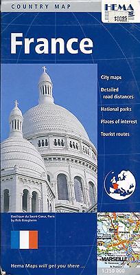
Map of France, by HEMA Maps
$ 2.61
- Description
- Size Guide
Description
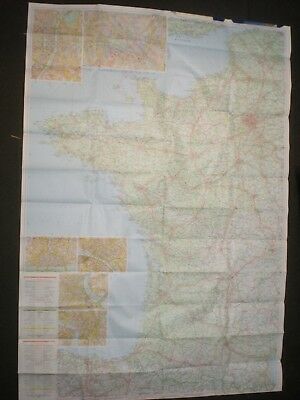
Map of France, by HEMA Maps - EXCELLENT LARGE SHEET MAP!East 1/2 on one side, West 1/2 on the other. Crazy detail.
A country map of France at a detailed scale of 1:750,000. National parks, points of interest, road distances and tourist routes are marked on the map, accompanying city maps of Paris, Strasbourg, Lyon and Marseille.
The map includes several insets showing enlargements of the major centres, Marseille, Reims, Strasbourg, Nimes, Lyon, Paris, Orleans, Rouen, Bordeaux and Tolouse. These insets show the city roads and mark the location of both important/useful and interesting buildings. There's also a handy distance chart.
The France travel map features:
* City plans
* National parks
* Places of interest
* Detailed road distances
* Tourist routes
The map is printed on paper and has a protective coated cardboard cover.
When unfolded, map measures approx. 44" x 36", scale is 1:750,000
Map retails for $ 10.95, publication date: 2009, ISBN
9781875992928
