-40%
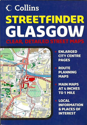
Atlas of Glasgow, Scotland, by Collins Map 'Streetfinder' Atlas
$ 3.14
- Description
- Size Guide
Description
Atlas of Glasgow, Scotland, by Collins Map 'Streetfinder' AtlasStreet Atlas, of Glasgow Scotland, with guide section, metro map, regional map, full indexed. 6" x 8.25", Softcover, Perfect Bound, 2005
Detailed, indexed, street atlas of Glasgow, with enlarged city center pages, route planning maps, and main maps at a scale of 1 "to 4 miles. Map shows ferry routes, railway lines parks, hotels, theaters, subway stations, postal boundaries , motorways, and urban streets. Also includes a rail network map. Legend is in English.
MAIN FEATURES
· Full color street atlas with roads color classified at 4 inches to 1 mile
· Full index to street names
· Local information pages
· Map of Strathclyde Transport Rail Network
· Map of Glasgow Airport
INCLUDES
· One way streets
· Car parks, railway and bus stations
· Post offices, police stations and fire stations plotted
AREA OF COVERAGE
The atlas covers an extensive area, including Cumbernauld in the north, Clydebank in the north west, Johnstone in the west, Easterhouse and Uddingston in the east and Barrhead and Giffnock in the south.
Copyright 2005, ISBN
9780007184668
